SKPOS Reference Data Shop
Generating SKPOS data for postprocessing is available through the Reference Data Shop for all registered SKPOS users with a valid contract from one of the services SKPOS_dm, SKPOS_cm or SKPOS_mm. Reference Data Shop is available through the SKPOS portal, after logging into your account.
Reference Data Shop allows self-service data generation for postprocessing for virtual reference stations or SKPOS reference stations. The resulting coordinates after processing with fixing of downloaded files are in the binding geodetic reference system ETRS89 (ETRF2000, epoch 2008.5).
Important information, requirements and restrictions:
- Supported formats of generated data are: RINEX 2.xx, RINEX 3.xx or Trimble formats (DAT, TGD, T01 and T02) with the possibility of selecting the recording interval: 1s, 2s, 5s, 10s, 15s, 20s, 30s and 60s,
- generated data must not be older than 6 months. For data files older than 6 months it is necessary to send us an individual request by email,
- for individual types of contracts, time limits are set for the maximum total length of data generation for postprocessing, i. the service will allow to generate only a specified number of hours of data according to the type of purchased contract. If you are interested in generating more hours, you need to purchase another access. The limits for individual types of contracts are set as follows:
- SKPOS_dm - 50 hours / year without recording interval resolution,
- SKPOS_cm - 50 hours / year without recording interval resolution,
- SKPOS_mm - 1000 hours / year without recording interval resolution.
Work procedure - instructions
After logging in to the account on the SKPOS web portal, select the Reference Data Shop in the left menu.
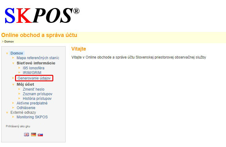
Data generation is procesed in the following steps:
- Click the Start a new data generation button,
- In the next window, select the type of station to generate data
- Permanent Reference Stations (CORS) or
- Virtual Reference Station (VRS)
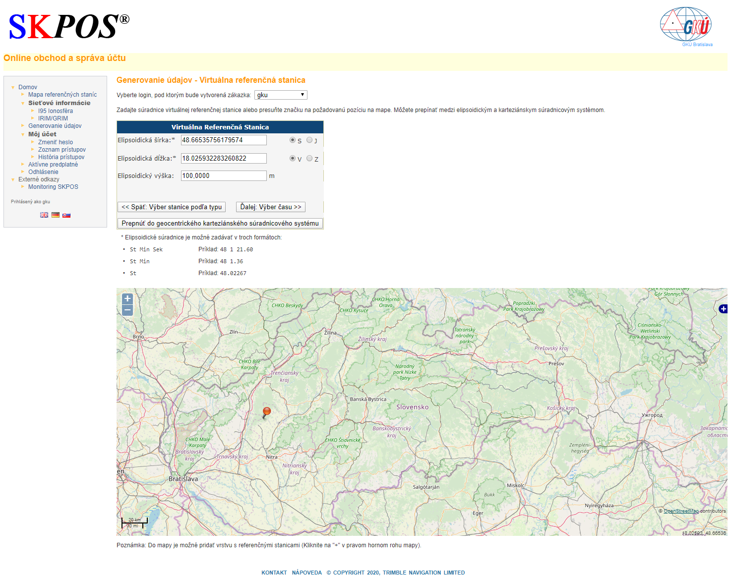
- If you select Virtual Reference Station (VRS), you must enter the VRS coordinates. The coordinates can be filled in in the form of ellipsoidal coordinates (ellipsoidal width, length and height), or in the form of geocentric coordinates X, Y, Z using the Switch to geocentric Cartesian coordinate system button, or by moving the icon on the map to the desired location.
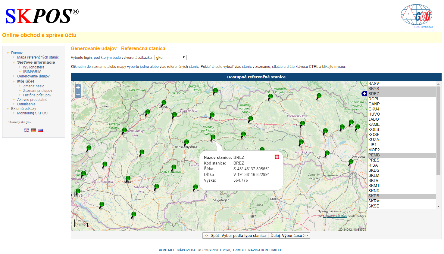
- If you select Permanent Reference Stations (CORS), you can select reference stations via the map or the list. If you are interested in selecting more reference stations, hold down the Ctrl key while selecting.
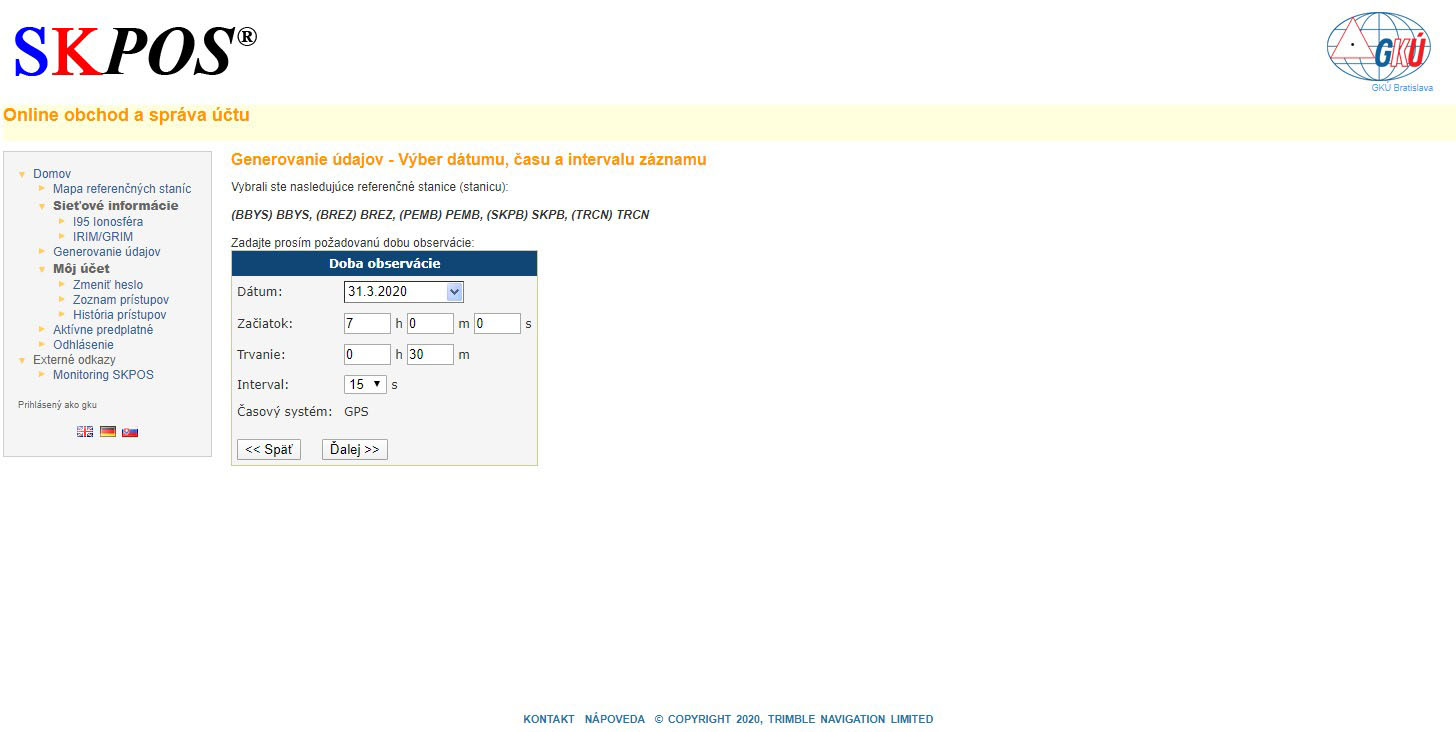
- In the next step, you need to enter the required time by selecting the date, start and duration of the required data, together with the recording interval.
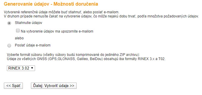
- The last step of generation is to select the method of delivery of generated data (download of generated data or send the generated data by email) and to select the format of output files according to the given options.
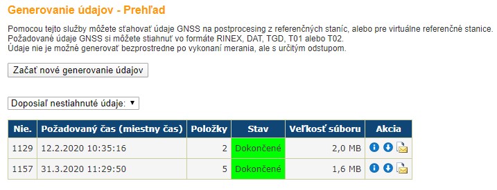
It takes a few minutes to generate the files, depending on the size of the data generated and the busyness of the server. You can view the status and history of generations in the basic menu Generating data.
Error messages
If an error occurs in any step of data generation, the software will display an error message. Try to enter the generation correctly again and if an error occurs, please, contact us.
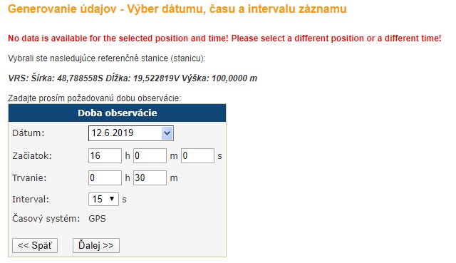
The most common sources of error are:
- start generating data younger than 2 hours,
- start generating data older than 6 months,
- start generating data for a period that is not accessible in the database for various reasons,
- entering the coordinates of the Virtual Reference Station outside the territory of Slovakia,
- service failure on the administrator's side.
Antenna parameters of SKPOS reference stations - calibration files
Some of antennas have precise position parameters and phase centre variations determined by individual absolute robotic calibration. On other antennas, during computation the values from so-called type absolute calibrations are used.
- Absolute calibrations of several SKPOS stations, you can find at Reference station site
- Type calibrations in antex format, you can download at International GNSS service (IGS)

