

Quality monitoring
GKÚ Bratislava undertakes to provide smooth and error-free operation of the SKPOS service as well as to ensure high quality of provided data for users using GNSS equipment to work in mandatory national geodetic datums ETRS89 and S-JTSK (in JTSK03 realization). To provide high quality data and services, continuous and independent monitoring is performed at three levels:
- real-time monitoring,
- quality monitoring of the network solution,
- continuous data quality monitoring of the reference stations.
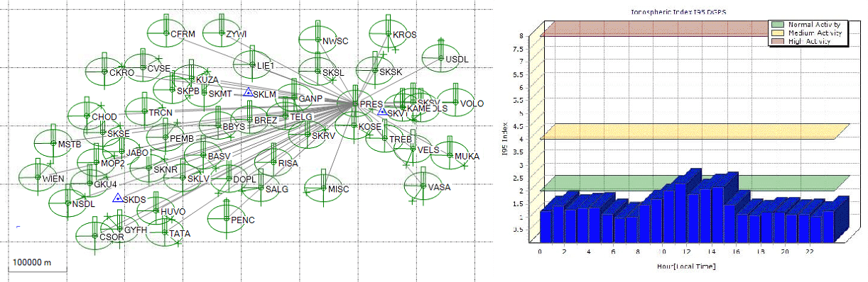
Real-time monitoring
The SKPOS control software (Trimble Pivot Platform) ensure real-time monitoring of the network integrity and several parameters, such as:
- monitoring of the reference station coordinates,
- monitoring of the ionosphere state,
- monitoring of the troposphere state,
- quality control of the observation data,
- prediction of geometrics errors.
Quality monitoring of the network solution
It is provided using the application developed at GKÚ Bratislava. The network solution monitoring is based on a virtual principle and uses open source program RTKNAVI, which is part of a software package RTKLIB. This program processes baselines created by a virtual reference station (VRS) generated from SKPOS (represents the field measurement of a virtual monitoring station) and a selected, as a rule the nearest, real SKPOS reference station. Criteria used to assess the network solution quality are deviations obtained from the coordinate differences between the computed and the known positions of the SKPOS® permanent stations used.
Monitoring of the network solution quality | desktop version
http://monitoringskpos.gku.sk
Monitoring of the network solution quality | mobile version
http://monitoringskpos.gku.sk/m
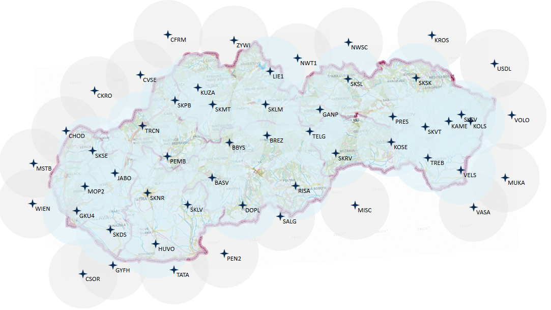
Sensor map
http://skposonlineobchod.gku.sk/Map/SensorMap.aspx
Continuous data quality monitoring of the reference stations
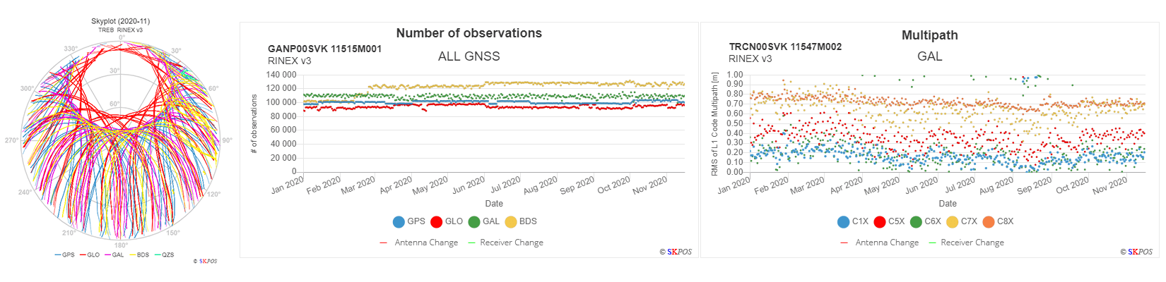
In addition to real-time monitoring of the service, a continuous fully automated data quality monitoring of the individual reference stations has been carried out since 2018. The principle is based on the daily processing and analysis of RINEX v3 files containing observational data from the reference stations. Daily RINEX files are analyzed by an open source tool G-Nut/Anubis (Geodetic Observatory Pecny, CZ) in order to obtain quality of the observations for monitoring station´s behavior and reveal potential HW/SW problems of station components. Verified RINEX files are used for processing of the SKPOS network solutions by a scientific software Bernese 5.2 in order to compute precise station coordinates in the ITRS and ETRS89 geodetic datums. Results from both processing and RINEX analysis are loaded to the SKPOS Quality Control v3 web app, which has been developing at GKU Bratislava since 2018. SKPOS Quality Control v3 enables to monitor:
Observations (RINEX):- availability of daily RINEX v3 files,
- percentage and number of observations for all GNSS and their available signals,
- multipath values,
- SNR (signal-to-noise ratio),
- skyplots.
 Final Solutions (SINEX):
- time series of topocentric coordinates of SKPOS stations,
- ambiguity,
- availability of daily and weekly SINEX solutions,
- SINEX quality parameters,
- troposphere parameters (ZTD, horizontal gradients).
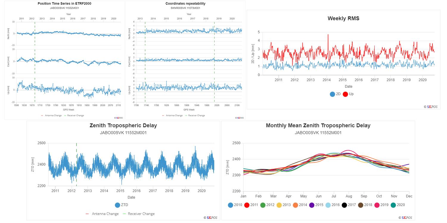
The generated time series provide real preview of the operation or the performance of the station and in case of antennas mounted on the ground also valuable information about the kinematics of the region the antennas are located in. In recently presented conclusions and results from the analyses of the SKPOS® stations time series it has been noted that the location and marking of the station have been selected correctly and despite a few discoveries concerning jump or anomalous performance of some stations (note: millimetre-level values), their markings fully meet the primary purpose of the service, which is provision of the reference frame for selected geodetic activities and work in the cadastre. By monitoring the quality parameters, it is possible to detect and predict potential hardware or software problems.