User Manual - SKPOS Online Postprocesing
SKPOS Online Postprocessing is available for all registered SKPOS users with a valid contract from one of the services SKPOS_dm, SKPOS_cm or SKPOS_mm. SKPOS Online Postprocessing is available through the SKPOS portal, after logging into your account.
SKPOS Online Postprocessing allows self-service loading of GNSS record performed by the static method on the territory of the Slovak Republic and calculates the resulting coordinates based on the processing of baselines against between the surrounding SKPOS reference stations and observed point, in the binding geodetic reference system ETRS89 (ETRF2000, epoch 2008.5).
Important information, requirements and restrictions:
- supported input formats of GNSS robservations are: RINEX 2.xx, RINEX 3.xx, Hatanaka-compressed RINEX files, Trimble formats (DAT, TGD, T01, T02 and T04),
- the length of the GNSS input record must be in the range of 10 min - 24 h, i. the service does not process a shorter or longer record,
- GNSS entry records must not be less than 1 hour and not more than 6 months old,
- GNSS records must be measured by the static method and must include code and phase measurements on two frequencies (L1 and L2 / L5), i. the service cannot process single-frequency measurements,
- If GNSS records consist of multiple files, they must be compressed into a ZIP file. All files in the ZIP archive must correspond to the same station location and must contain identical information in the file header (receiver type and antenna type),
- the service processes coordinates for individual points, it cannot process a network of several points at once and balance them,
- for individual types of SKPOS contracts, time limits are set for the maximum total length of GNSS input records, i. the service will allow to process only a specified number of hours of GNSS recording according to the type of contract purchased. If you are interested in processing a larger number of hours, it is necessary to purchase another access. The limits for individual types of contracts are set as follows:
- SKPOS_dm - 50 hours / year without recording interval resolution,
- SKPOS_cm - 50 hours / year without recording interval resolution,
- SKPOS_mm - 1000 hours / year without recording interval resolution.
How to work with SKPOS Online Postprocessing?
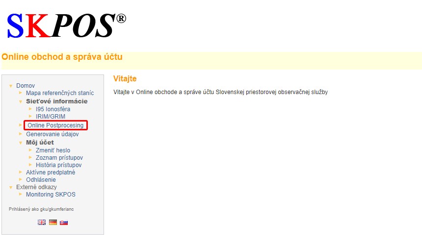
After login to your SKPOS portal select the Online Postprocesing in the left menu.

New calculation (GNSS static method) is performed in the following steps:
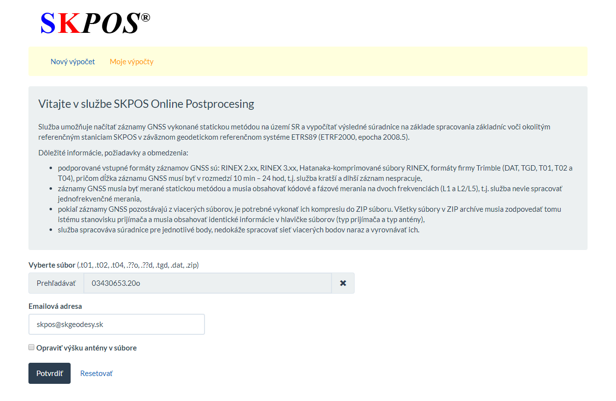
- Use Browse to select the GNSS observation file you want to process in one of the supported formats listed.
- in the E-mail address field, fill in the e-mail address where the e-mail with the results will be sent,
- If you are interested in adjusting the antenna height in the downloaded file, check the Change antenna height in the file item and correct the incorrectly stated height.
- Click the Confirm button to submit the calculation for processing.

The calculation takes a few seconds to minutes, depending on the length of the observation time of the uploaded file and the busyness of the server.
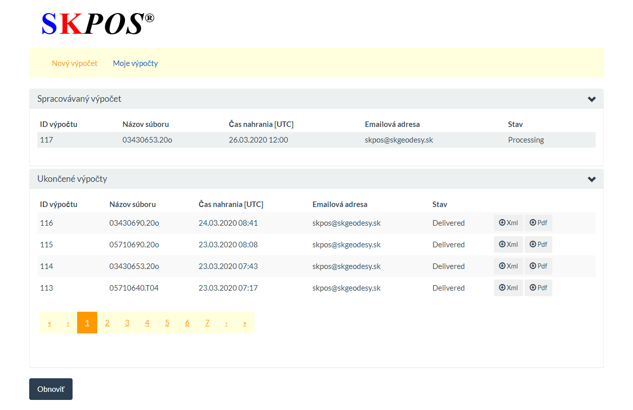
In the My Calculations tab, you can view and check the status, result and history of calculations. Click the Refresh button to refresh the current calculation status information. You will also be informed about the result of the calculation by e-mail at the specified e-mail address.

The calculation of the GNSS static measurement is based on the combine processing of baselines between the six nearest SKPOS reference stations and the observed point. If one of the baseline cannot be processed, the calculation will be performed with a smaller number of baselines. All successfully processed baselines are included in the calculation of the resulting coordinates. The resulting coordinates are in the ETRS89 reference system (ETRF2000 epoch 2008.5).
Result - report
The result of the processing is available in PDF and XML format in the My Calculations tab, or in a PDF sent to the specified Email address. The report with the result contains:
- Input data information:
- calculation ID,
- input observation files,
- date,
- receiver type,
- antenna type,
- antenna height,
- antenna reference point.
- Calculation information:
- start and end time of the measurement,
- GNSS method,
- interval of observations,
- type of ephemerides used,
- reference system,
- tectonic plate.
- Information about processed baselines:
- used reference stations,
- baselines length,
- GNSS observation statistics,
- number of observed satellites,
- Processing result
- geocentric coordinates with standard deviations,
- ellipsoidal coordinates with standard deviations,
- Remark: Standard deviations marked with red color (if exceed critical values of 0,02m in Lon/Lat and 0,05m in ellipsoidal height. Please, consider that results for your work.
- Report information:
- software version,
- report date.
Errors
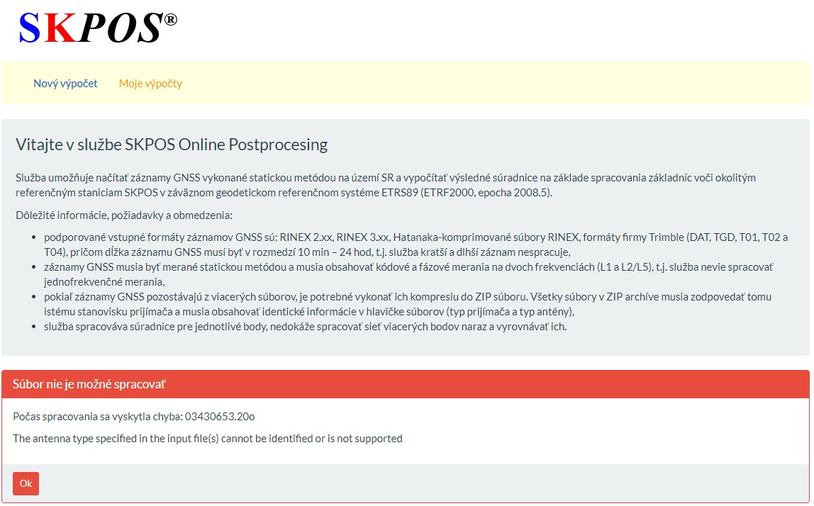
If an error occurs in any of the processing steps, SKPOS Online Postprocessing will print an error message. Try to enter the calculation correctly again and if the error occurs again, please, contact us.

The most common sources of error are:
- input observation file is younger than 1 hour,
- input observation file is older than 6 months,
- uploading a file with observations interval less than 10 minutes or more than 24 hours,
- uploading a file with a "poor" GNSS observations e.g. from static measurements with a low number of satellites or with an intermittent recording of GNSS observations (forest measurements),
- reading a single-frequency GNSS record,
- reading an observation file of an unknown format, or an unknown receiver or antenna type.

